What are 15-Minute Cities
The concept of the 15-minute city is a revolutionary urban planning model. It aimes at
creating cities where residents can access most of their daily needs within a 15-minute
walk or bike ride from their homes. This idea emphasizes reducing car dependency,
enhancing local services, and fostering sustainable living environments. 3D renderings
and Augmented Reality (AR) play a crucial role. Planners use both to design and
visualize these urban landscapes, enabling them to create efficient, functional, and
aesthetically pleasing cities.
Urban planners design 15-minute cities so that all essential services—like work,
education, shopping, and leisure—are within a 15-minute walk or bike ride. Unlike
traditional cities that require long commutes and lead to congestion and pollution, these
areas are more compact and efficient. They focus on sustainability and improving
quality of life. At our company, we are committed to embracing this forward-thinking
model. We focus on innovative planning and design that aligns with the principles of 15-
minute cities. We believe this approach represents the future of urban living, creating
vibrant, sustainable communities for generations to come.
Key components
A 15-minute city relies on mixed-use development, where residential, commercial, and
recreational spaces are integrated within proximity. 3D renderings help planners design
these mixed-use areas by visualizing how different functions can coexist harmoniously.
For example, they can show how residential buildings can be complemented by nearby
parks, shops, and workplaces. This creates a vibrant and convenient neighborhood
Efficient public transportation is essential for a 15-minute city. 3D renderings can
illustrate the integration of public transit options like buses, trams, and bike-sharing
stations within the urban fabric. By visualizing these elements, planners can optimize
routes, station placements, and connectivity. This ensures that public transportation is
both accessible and efficient for residents.
Green spaces are vital for promoting a healthy and sustainable urban environment. 3D
renderings allow planners to design parks, gardens, and other green areas in a way that
maximizes their accessibility and usability. These 3D renderings can show how green
spaces interact with surrounding buildings and streets. As a result, helping to create a
balanced and aesthetically pleasing urban landscape.
3D Renderings in action
Paris is actively working towards becoming a 15-minute city. The city has utilized 3D
renderings to plan and visualize extensive transformations. These renderings have
helped planners reimagine streetscapes, pedestrian zones, and public spaces. By
visualizing the proposed changes, the city has been able to communicate its vision
effectively to residents. They gathered valuable feedback, ensuring that the final design
meets the community's needs.
Portland has embraced the 15-minute city concept by focusing on creating walkable
neighborhoods with easy access to amenities. 3D renderings have been instrumental in
this process, allowing planners to design mixed-use developments and green spaces
that enhance the city's livability. 3D renderings have also been used to model traffic
patterns and improve public transportation routes. Doing this, they ensured seamless
connectivity across the city.
Melbourne is another city that has leveraged 3D renderings to advance its 15-minute
city goals. The city has used these visual tools to plan new residential and commercial
developments. They also help integrate public transportation and enhance green
spaces. By providing a realistic preview of proposed projects, 3D renderings have
improved decision-making and gained community support for urban transformation.
The role of 3D renderings
3D renderings are computer-generated images that provide a realistic representation of
buildings, landscapes, and urban spaces. These images are created using specialized
software that translates architectural and urban design plans into three-dimensional
visuals. 3D renderings can include detailed textures, lighting, and perspectives that
mimic real-life environments. That´s why they are an invaluable tool in the design
process.
One of the primary benefits of 3D renderings is the ability to visualize complex urban
designs such as 15-minute cities in a realistic manner. This enhanced visualization
helps urban planners and architects understand how a 15-minute city will look and feel
before any construction begins. Seeing a lifelike representation of the proposed
cityscape can facilitate better decision-making and more informed discussions among
all parties involved.
3D renderings improve communication between designers, planners, and the
community. Traditional 2D plans and blueprints can be challenging to interpret for those
without a background in architecture or urban planning. 3D images, on the other hand,
are intuitive and easy to understand, making it easier to convey design concepts to a
broader audience. This clarity fosters greater community engagement and support for
urban development projects.
Before construction begins, it is crucial to identify and address potential design issues.
3D renderings allow planners to spot problems that might not be evident in 2D plans.
For instance, they can reveal how buildings cast shadows on public spaces or how
traffic flows might be affected by new developments. Addressing these issues early in
the design process helps planners save time and resources. It also ensures a more
efficient implementation.
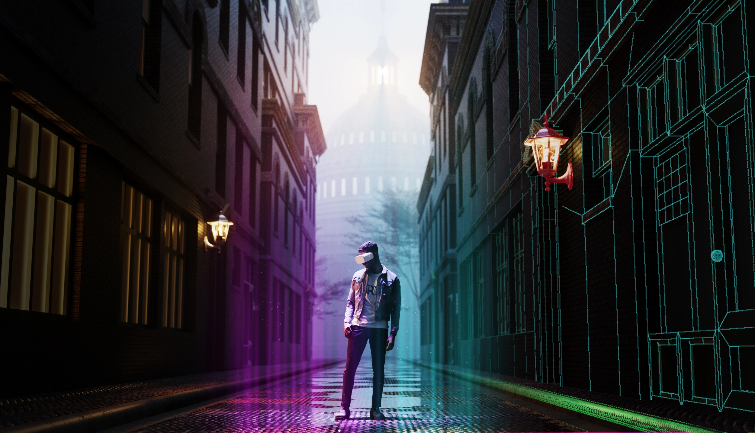
How Augmented Reality can aid
Augmented Reality (AR) is a powerful tool that can significantly enhance the design and
planning of 15-minute cities. It´s a topic we are very curious about, in fact, we wrote our
Top 10 predictions for Augmented Reality. These urban areas prioritize accessibility,
ensuring that residents can reach essential services within a 15-minute walk or bike
ride. AR technology can support this concept in several ways:
Firstly, Augmented Reality provides urban planners and architects with immersive
experiences. It allows them to visualize and interact with urban environments in three
dimensions. This can help in understanding the spatial dynamics and optimizing the
layout to ensure accessibility. Planners can walk through virtual models of proposed
neighborhoods to identify potential issues and make necessary adjustments before
actual construction.
In the second place, it enables effective communication with different participants,
including residents, businesses, and government officials. This participatory approach
ensures that the final design meets the needs and preferences of the community,
fostering a sense of ownership and satisfaction.
Also, Augmented Reality allows for the simulation of various scenarios, such as traffic
flow, pedestrian movement, and emergency evacuations. These simulations can help
planners test the efficiency and safety of the proposed design under different
conditions. For instance, AR can simulate rush hour traffic to assess the impact on
commute times and identify potential bottlenecks.
Finally, AR can visualize the environmental impact of urban development, such as
changes in green spaces, air quality, and noise levels.
In summary, AR technology can transform the design of 15-minute cities by offering
immersive planning tools and improving community engagement. It also allows for
better testing and supports environmental sustainability. This approach ensures that
urban areas are efficiently designed to meet the needs of their residents.
The challenges and the promising future
One of the challenges associated with 3D renderings is the cost. Creating detailed and
realistic renderings requires significant resources, including specialized software,
skilled personnel, and time. For smaller projects with limited budgets, these costs can
be prohibitive. However, as technology becomes more accessible and affordable, the
use of 3D renderings is expected to become more widespread.
While 3D renderings are highly realistic, they are not always perfect representations of
the final outcome. Discrepancies may appear. Factors such as changes in project
scope, budget constraints, and unforeseen construction challenges can result in
deviations from the original design. Planners must be cautious. They must use 3D
renderings as a guide rather than an absolute blueprint, remaining flexible to adapt to
changing circumstances.
The future of 15-minute cities is ready to transform urban living, making communities
more sustainable, resilient, and connected. As cities embrace this model, we can expect
a shift towards reduced car dependency, lower carbon emissions, and enhanced quality
of life. The integration of smart technologies and green infrastructure will further
support these compact, efficient urban areas. However, challenges like fair access,
housing affordability, and infrastructure upgrades must be addressed to fully realize
this vision. Ultimately, 15-minute cities represent a promising future where convenience,
sustainability, and community thrive in harmony. Time will tell.
Conclusion
In conclusion, the 15-minute city concept is a groundbreaking approach to urban
planning. It fundamentally reshapes how we design and interact with our cities. By
focusing on accessibility, sustainability, and community, this model aims to create
urban environments where residents can meet their daily needs within a short walk or
bike ride from their homes. This approach not only reduces car dependency and lowers
carbon emissions but also fosters vibrant, connected communities.
The integration of advanced tools like 3D renderings and augmented reality has been
pivotal in bringing the vision of 15-minute cities closer to reality. These technologies
enable urban planners to visualize and refine complex designs, ensuring that new
developments are both functional and aesthetically pleasing.
However, the journey toward realizing 15-minute cities comes with challenges.
Visualization tools are not cheap and potential deviations from original designs are key
concerns. Additionally, significant infrastructure upgrades are often needed. Despite
these hurdles, the potential benefits are enormous. As cities worldwide begin to
embrace this model, in The Rendering Company, we are likely to see a future where
urban living is more sustainable, resilient, and community-oriented. The 15-minute city
offers a promising blueprint for the cities of tomorrow. This model prioritizes
convenience, environmental care, and social cohesion.
If you want to know more, please visit www.therenderingco.com